Our own tiles: harbours, gates and a lighter map

Until this week the Adventure basemap was a FastGIS style on top of stock OpenMapTiles tiles. Everything the style could learn, it had learned; what was left was what the tiles never carried. So now we bake the tiles ourselves, with a profile of our own, and the map shows harbours, gates on forest roads and track grades. It also stopped carrying thousands of points of interest it could never draw.
Harbours that are not paper
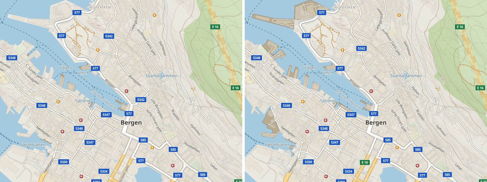
OpenMapTiles has no marinas, docks, breakwaters or quays. In Bergen the moles and quay aprons of Vågen were drawn as open land; at Sanxenxo the marina was an outline around nothing. Our tiles now carry a harbour layer. Basins are a quiet tint over the water, quays and moles are decks with a structure edge, and a breakwater is the line the sea breaks on. A footway that runs along a jetty is now drawn as the jetty, not as a dashed path across the water.
The gate before the forest road
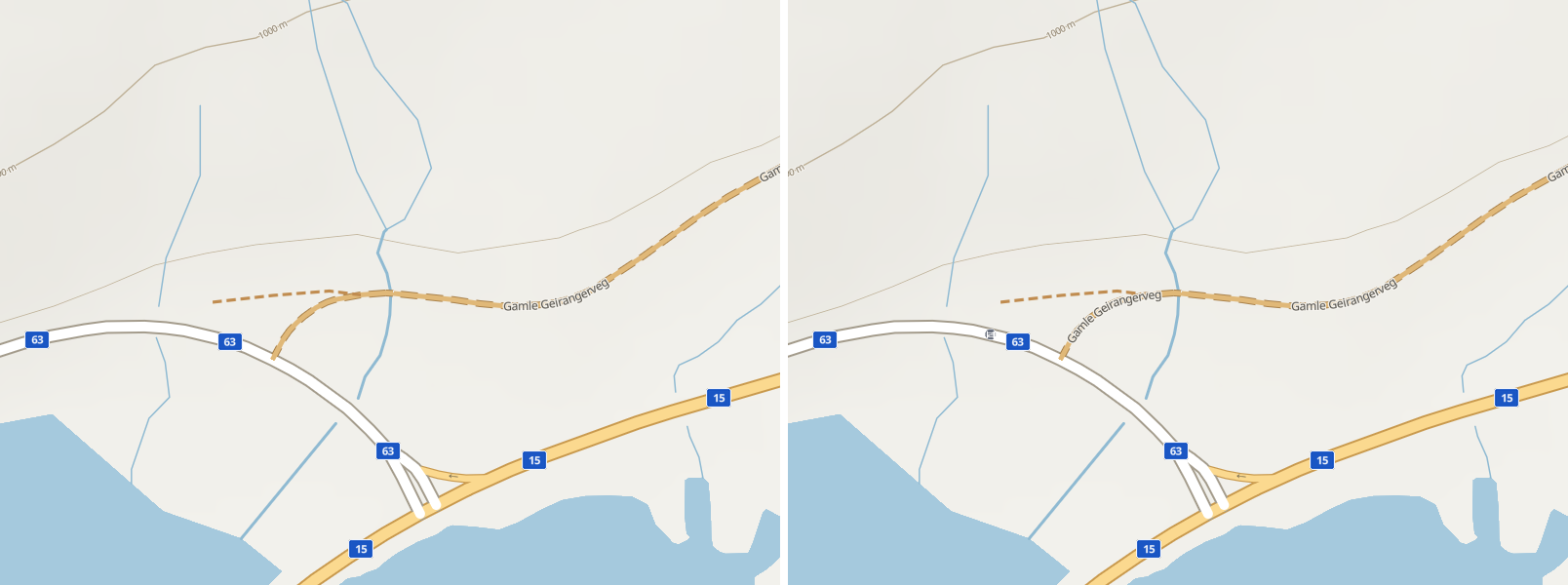
A locked gate is the fact a rider most wants before committing to a gravel road. The new tiles carry gates, bollards and cattle grids, but only where a road or track actually runs through them, and the map shows them as small badges from z15. A gate tagged as locked is red. The bollards of city footways and the lift gates of car parks are left out, and every barrier badge yields to a road name or a point of interest when they collide.
A lighter map, with the right badges
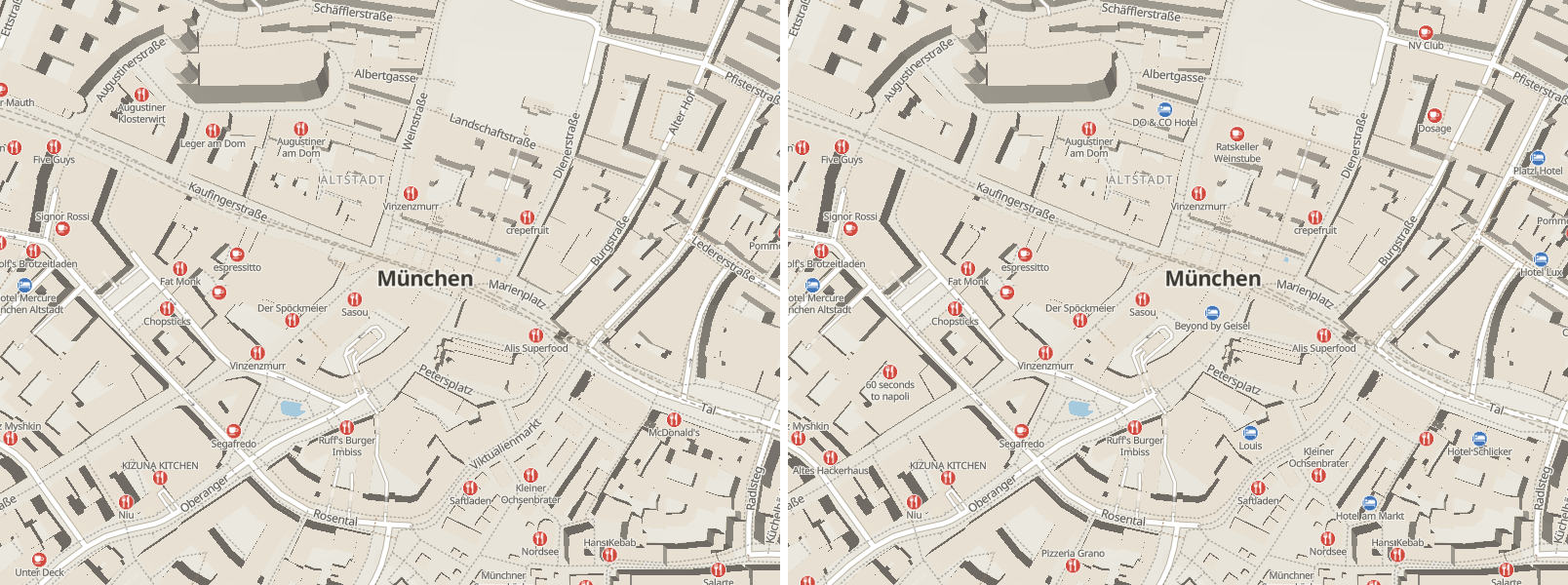
The stock tiles carried every point of interest OpenStreetMap knows: waste baskets, bike stands, hairdressers. The map could draw none of them. Our profile keeps only what the map draws, and ranks what a rider stops for first: fuel, charging, hospitals, campsites, huts, shelters, drinking water. Springs and wells now count as water. A Munich centre tile went from 7 290 points of interest to 1 998, and from 342 KB to 200 KB. The whole Europe archive is 2.4 GB smaller.
Because a point's rank now counts only against things the map can draw, the badge budget was retuned so a city centre keeps the density it had. Munich at z16 shows 45 badges instead of 35, and the road names stay readable.
The tiles also carry what a rider picks a stop by, ready for the map and the app to use. A fuel station lists its fuel types, a charger its sockets and capacity. A campsite says whether it takes tents or charges a fee. A shelter says whether it is a hut or a bus stop. Surface now reaches the regional view from z8. Tracks carry their grade, smoothness and whether motorcycles may use them.
If you have the offline Europe map
A Europe map you already downloaded keeps working and draws exactly as it did. Every new layer is optional in the style, and we checked that the old tiles render the same labels with the new style at every test site. The app does not replace a downloaded map on its own. To get harbours and gates offline too, delete the Europe map under Offline basemap in the app's settings and download it again. The new download is 2.4 GB smaller.
The details of what the map draws are on the Adventure basemap page.